


The Dam Rock Station Playing Anything that Rocks!!
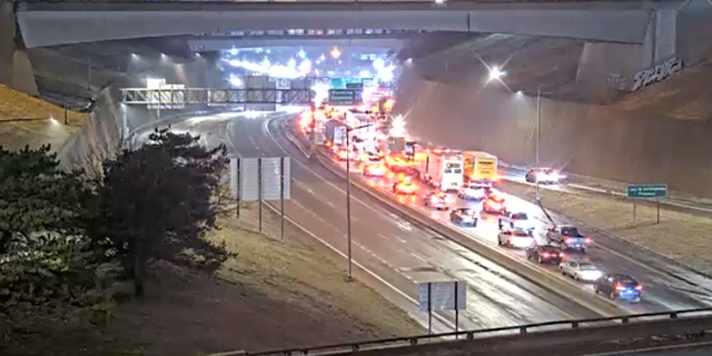
NEW YORK – A winter storm that brought traffic to a standstill in the Midwest on Wednesday morning is now setting its sights on major cities in the Great Lakes region Wednesday night before heading to snarl morning commutes in the Northeast on Thursday, with over 100 million under winter alerts.It’s the first in a pair of high-impact ice storms that has millions of people across nearly two dozen states on alert due to the widespread impacts of freezing rain and other winter weather.DON’T LEAVE ANY OF THESE ITEMS IN YOUR CAR THIS WINTERWinter Weather Advisories stretched Wednesday night across over 1,500 miles from Nebraska to Maine, with forecasters warning that icy conditions could lead to slick roads overnight and into Thursday.That puts Thursday morning commutes across multiple major metro areas in peril, including cities like Chicago, and Columbus and Cleveland in Ohio, Philadelphia, Washington, D.C and New York City.HERE’S WHY YOU SHOULD NEVER STORE FOOD OUTSIDE DURING A WINTER POWER OUTAGEThe NWS office in Cleveland was one of many NWS offices asking drivers to avoid travel if possible.”Freezing rain will begin to transition to light rain early Thursday morning,” Cleveland forecasters said. “However, slick spots may linger through mid-morning as surface temperatures remain chilly in the mid-30s.”REMOVING ICE FROM YOUR WINDSHIELD CAN BE EASY – IF YOU DO IT THE RIGHT WAYThe FOX Forecast Center said that dangerous travel conditions appear to be the biggest impact of this storm in those locations. Forecasters believe ice accretions across the Midwest should remain low enough that only scattered power outages could occur.HOW TO DRIVE IN ICY CONDITIONSAreas to the east will see the highest potential for significant icing – especially in portions of Maryland and into the Laurel Highlands of Pennsylvania.Ice Storm Warnings covered parts of four states. Power outages and tree damage are most likely in those locations, as ice accretions greater than a quarter-inch and maybe as high as a half-inch are possible.”We’re going to see the freezing rain there start after midnight (Wednesday night), so that is going to be the icing event we are calling for and afraid of,” FOX Weather Meteorologist Bob Van Dillen said. WHY DO BRIDGES AND OVERPASSES FREEZE BEFORE ROADS?The Pennsylvania Department of Transportation said PennDOT and the Pennsylvania Turnpike implemented vehicle restrictions across Pennsylvania starting Wednesday and lasting through Thursday due to the anticipated impacts of the ice storm.7 WAYS TO STAY SAFE WHILE USING A GENERATOROutside that region, freezing rain is expected to fall along the busy Interstate 95 corridor from Washington up through southern New England.The FOX Forecast Center said that from the New York City area northward, the cold air will be deep enough that snow will be a concern during the onset of the winter weather with periods of snow likely between about 3-8 a.m. before briefly changing to freezing rain then warming to just rain. Other cities like Hartford, Connecticut, and Boston could see snow falling during the middle to latter part of the Thursday morning commute.DRIVING ON THE ICE AND DRIVING IN THE SNOW: WEATHER DRIVING TIPS FOR DRIVING IN INCLEMENT WEATHERThat could wreak havoc on the roads, but the FOX Forecast Center said that much like in the Midwest, warm air will move in, changing the snow to either freezing rain or plain rain.Any snow left behind will nearly completely melt.6 BASIC STEPS FOR PROPERLY MEASURING SNOWBut farther to the north across northern New England, the snow will continue through the day on Thursday and may not change over north of Interstate 90. The FOX Forecast Center said that locations picking up 6 inches of snow or more would likely be found there.The system will then quickly exit New England by Thursday evening, leaving mainly dry conditions on Thursday night and Friday.PROTECTING YOUR PET: WHY ICE MELTS CAN BE DANGEROUS FOR YOUR FURRY FRIENDSThe storm first made its presence felt in the Midwest Wednesday morning, unleashing a travel nightmare across portions of Kansas and Missouri.HOW TO WATCH FOX WEATHEROfficials say there were multiple reports of stalled and crashed vehicles on roads and highways from Topeka, Kansas, to Kansas City, Missouri, and cameras showed traffic at a standstill as a result.The biggest impacts were on major highways in the area, including Interstate 35, Interstate 70, Interstate 670 and Interstate 435.A video from the area showed a sea of red taillights on I-35 after the road was shut down due to a crash. The road has since reopened.TRAVELING THIS WINTER? HERE’S WHAT TO KEEP IN YOUR CAR IN CASE YOU GET STUCKSchools have also been closed across the region, with some districts canceling classes altogether or moving students to virtual learning.The FOX Forecast Center said a second, even stronger storm is expected this weekend.The storm is also expected to bring freezing rain to nearly the same areas that impacted during this first storm.However, the FOX Forecast Center said there would be one major difference – this next storm will pack much more snow.Heavy snow is looking increasingly likely on Saturday across the Upper Midwest and Great Lakes region.Cities like Minneapolis, Milwaukee and Detroit could see their biggest snowstorm so far this winter.That storm will reach the Northeast on Saturday night and produce another round of snow, sleet and freezing rain.The FOX Forecast Center said that, like this first storm, Pennsylvania again appears to be in the bull’s eye for highly impactful ice.Rain is looking likely in the Ohio Valley and the Appalachians. Potentially heavy rain will be most concerning in the central Appalachians, and some flooding is possible.