


The Dam Rock Station Playing Anything that Rocks!!
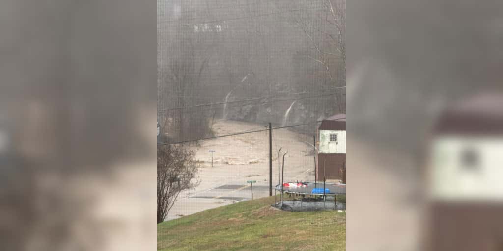
HURLEY, Va. – Deadly flash flooding swept across parts of four states on Saturday as a potent storm system produced a myriad of threats across the eastern half of the nation.Numerous reports of impassable roads dotted the map in western Tennessee, southern Kentucky and near the West Virginia-Virginia border where rainfall reports climbed to over 5-8 inches during the first half of the weekend with more rain still to come.The threat was significant enough to trigger precautionary evacuations along some streams and rivers in the Tennessee Valley and forced the opening of some shelters.A nursing home in Red Boiling Springs, Tennessee, near the state border with Kentucky, was evacuated out of an abundance of caution and water rescues were reported to be ongoing around Hurley, Virginia.And while the rainfall may lighten up in some areas, the threat of flooding is expected to continue into the workweek as several rivers remain high with crests not expected for several days.HOW LA NINA IMPACTED THE TOPSY-TURVY WINTER OF 2024-2025The Clay County, Kentucky Coroner’s Office reported that a 73-year-old man from the Blue Grass State was found dead in the Horse Creek area of Clay County after apparently getting knocked off his feet by rushing water while exiting his vehicle around Highway 80.At the time, the coroner’s office said it was treating the event as an accidental drowning because of the heavy weather and was the only weather-related fatality in the county despite widespread flooding.In Corbin, Kentucky, flood waters carried a truck off a road and into nearby ditch, according to a storm report from the area’s National Weather Service office.Near Lewisburg, Kentucky, swift water rescue teams were needed to rescue a driver who became trapped in swift waters of the swollen Mud River, the NWS reported. Another water rescue was needed to the west in the town of Murray.Kentucky Governor Andy Beshear issued a state of emergency for the commonwealth before the weather and warned that 3-5 inches of rainfall would be problematic for some areas. “We want everyone to be careful,” Beshear stated. “The amount of rain coming down will make it hard to drive, and flash flooding, especially across our roads, can create dangerous conditions. And remember, don’t drive through standing water, it can have a current, and it is incredibly dangerous.”NOAA’s Weather Prediction Center issued their most dire level 4 flash flood threat rating of “extreme” for parts of northwestern Tennessee and southwestern Kentucky, but it was communities along the West Virginia-Virginia border that appeared to be the hardest hit from the flooding.Several rare Flash Flood Emergencies were issued by the NWS office in Charleston, West Virginia, for communities around the border region as rain fell on already saturated grounds, causing streams and rivers to quickly flood.Catastrophic flooding was reported to be ongoing Saturday in communities such as Hurley and Grundy, where roadways simply turned into streams and became dangerous.Several rockslides were reported and Gov. Glenn Youngkin said he’s deployed the National Guard among other first responders to the area.WHY RARE ‘HIGH RISK’ FLOOD DAYS NEED TO BE TAKEN SERIOUSLYHigh risks are only issued on about 4% of days, but this risk category accounts for 39% of flood-related fatalities and 83% of flood-related damage in the continental U.S., according to research by WPC meteorologists. About half of such alerts result in at least one death.A Level 3 out of 4 risk for flash flooding expands farther out into the Ohio and Tennessee Valleys as potential exists for numerous flash floods, some of which could be significant. Flood Watches have been issued that extend over 900 miles from Arkansas to Pennsylvania. About 11 states are included under these.