


The Dam Rock Station Playing Anything that Rocks!!
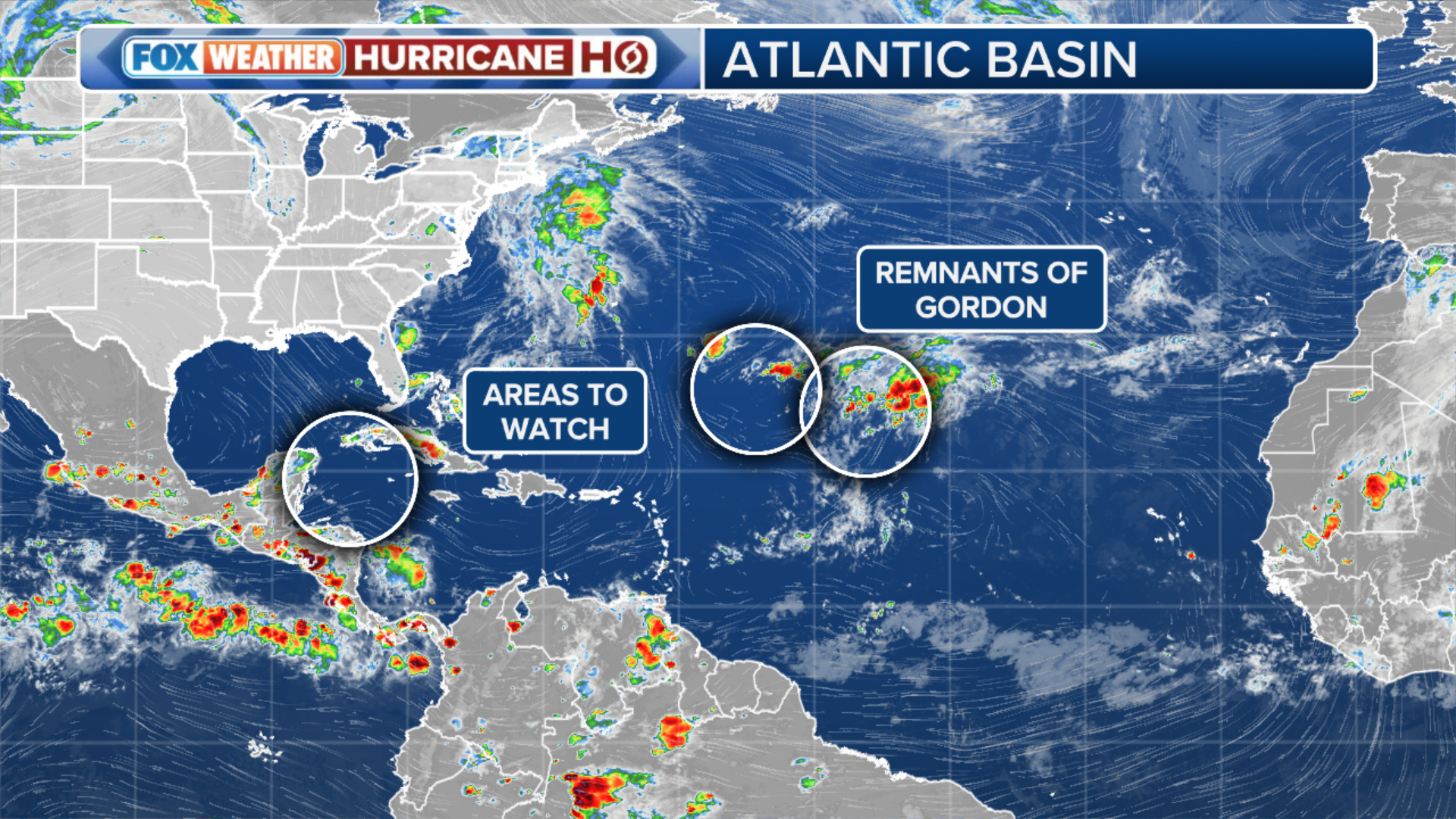
As the likelihood of the next tropical threat in the Atlantic increases, the National Hurricane Center (NHC) is now closely watching a total of three areas for the possibility of development.Gordon is no longer a tropical cyclone. It is barely producing storms around its center, and recent satellite data indicates it does not possess a well-defined, trackable center. However, the NHC said the remnants of Gordon are associated with an area of disorganized showers and thunderstorms over the central tropical Atlantic. “This system is forecast to interact with another area of low pressure to its west while moving north-northeastward at 5 to 10 mph during the next couple of days,” the NHC said in its latest outlook. While environmental conditions appear only marginally conducive for additional development by the end of this week, the NHC said a tropical depression or storm could still redevelop in a few days.So could Gordon come back? The answer is yes, but it’s not clear if it keeps the name Gordon or receives a new name. That’s up to the NHC. Regardless of its designation, the system will continue to stay well out to sea and remain the only storm this hurricane season not to make landfall, according to the FOX Forecast Center.The NHC is monitoring a region of the Caribbean and Gulf of Mexico for potential tropical development. Atmospheric conditions are becoming increasingly favorable for the formation of a named storm sometime next week.The growing concern is linked to the Central American Gyre, a weather pattern known to contribute to tropical storm development in the region during early spring and autumn. While the current odds of development are medium, the situation warrants close monitoring, according to the FOX Forecast Center. TRACKING TROPICAL DISTURBANCE IN CARIBBEAN, GULF OF MEXICO AS CENTRAL AMERICAN GYRE STIRSShower and thunderstorm activity has increased with a well-defined area of low pressure located a few hundred miles to the northwest of the remnants of Gordon. Environmental conditions appear only marginally conducive, but some additional development of this system is possible as it meanders over the open waters of the central or western subtropical Atlantic through early next week.The National Hurricane Center has labeled the area of disturbed weather as Invest 96L, but it poses no threat to any landmasses.An “invest” is simply a naming convention used by the NHC to identify areas they are investigating for possible development. Once a system is dubbed an invest, a collection of specialized datasets and computer forecast model guidance can begin. These computer models simulate the system’s projected track possibilities and predict its future intensity.