


The Dam Rock Station Playing Anything that Rocks!!
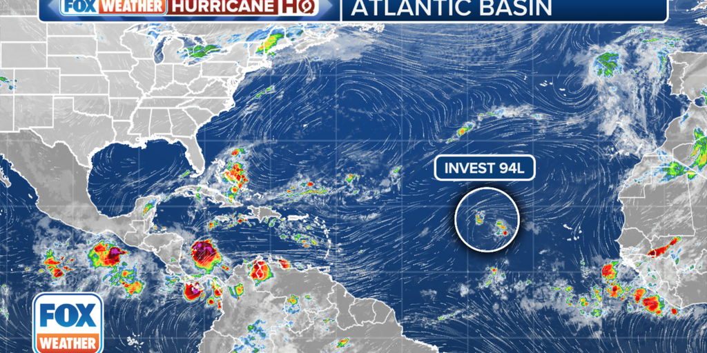
MIAMI – An area of disturbed weather in the eastern Atlantic is continuing on its long journey to the west, and forecasters with the National Hurricane Center (NHC) say it could become a tropical depression as the system moves into an area that’s favorable for tropical development.The disturbance, which has been designated Invest 94L by the NHC, is located several hundred miles to the west of the Cabo Verde Islands and even brought tropical-storm-force winds and heavy precipitation to the archipelago on Friday night.WHAT IS AN INVEST?The NHC says the system has become well-defined, but it’s producing minimal shower and thunderstorm activity and is in an area that’s unfavorable for further development.”However, this system is forecast to move generally westward to west-southwestward, and environmental conditions could become more favorable for gradual development by the middle or latter part of this week,” the NHC said.As it does so, the NHC says a tropical depression could form as the system approaches or moves near the Leeward Islands by the end of the week.The NHC is giving the system a low chance of developing over the next two days, and a medium chance of developing over the next week.