


The Dam Rock Station Playing Anything that Rocks!!
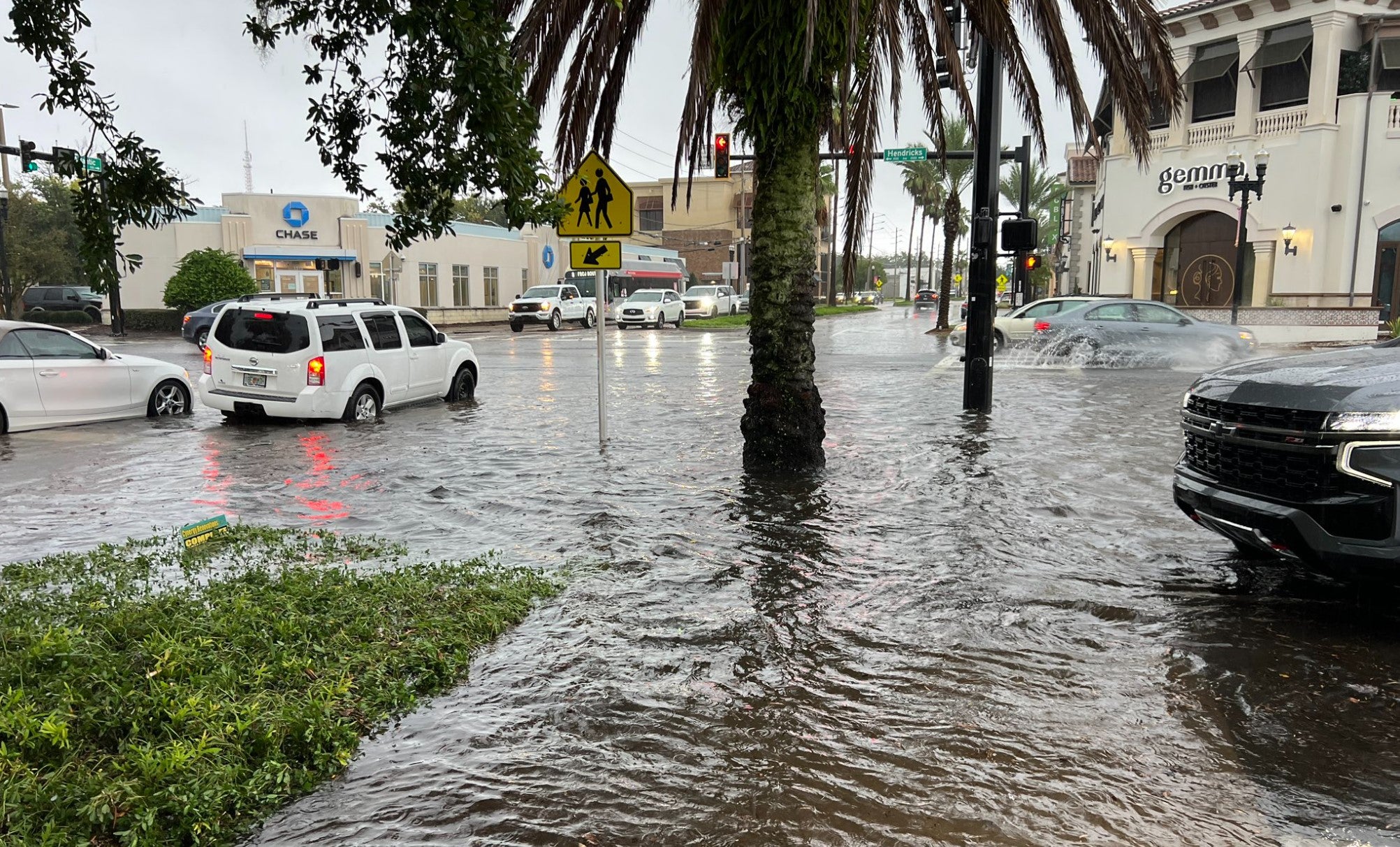
Scenes of flooding that have been all too common around Jacksonville, Tamp, and other communities north of Interstate 4 could continue for the foreseeable future, as a stalled frontal boundary remains the focus for showers and thunderstorms. The widespread rainfall began Tuesday across the Peninsula and has shown no signs of slowing, as rounds of tropical moisture stream into the Sunshine State.Due to the nature of the precipitation, many areas in North and Central Florida have received between 3 and 5 inches of rainfall, though some Doppler radar estimates suggest more than a foot of rainfall in certain communities.The area around Tampa International Airport was one of the locales that experienced substantially more, with over 8 inches of precipitation falling in just 48 hours.The rainfall totals and flooding are similar to what a hurricane usually produces, even though there isn’t one, as it is the relatively quiet 2024 hurricane season, after all.”We don’t need ‘rain with a name’ for flooding impacts”, the National Weather Service office in Jacksonville, Florida, said.HURRICANE FORECASTERS EXPECT BELOW-NORMAL CYCLONE ACTIVITY THROUGH SEPTEMBER’S SEASON PEAKAs long as the frontal boundary is draped across the state, chances of precipitation will remain in place.Forecast models show an additional 3-7 inches over the next week, with isolated areas seeing more.Where bands develop and train over the same area, the flood threat will be highest, which will be generally to the south of the frontal boundary.Flood Watches were posted for counties along Interstate 10 west of Tallahassee through at least the first half of the weekend and were in place for the metro Jacksonville region through the end of the workweek.So far, damage from the flooding has been relatively limited, but as saturated grounds lead to less water absorption, impacts are expected to increase.Most flooding scenes have involved drivers venturing into waters that were too high for their vehicle.7 FACTS YOU SHOULD KNOW ABOUT FLASH FLOODSIf your vehicle becomes partially submerged in floodwaters, experts at AAA advise you to never attempt to start the engine because it could further damage the engine.Instead, start by taking photos of the damage both inside and outside for your insurance company.Once you contact your insurance representative, they’ll advise you of the next steps, which will likely involve a claims adjuster and a tow to a certified mechanic.Mike Porcelli, a mechanic and automotive technology consultant, previously told FOX Weather that most insurance companies will declare a vehicle a total loss, even with no visible damage.”Everything is controlled by computers. The power windows are controlled by a computer. The lights are controlled by computers. So, every electronic system from the engine to the transmission, tail lights, even the radio is controlled by computers” Porcelli said. “Some of those computers are down under the seats or up under the dashboard, down low. If water gets into the car and floods the floor of the car, those computers are subject to getting waterlogged.”