SIOUX FALLS, S.D. (KELO) — I hope you were able to enjoy the largely quiet day today. It’s going to get a bit messy as we head into the midweek outlook.
Rain will start to push into KELOLAND as we go into the later part of the evening and overnight. Some snow may mix in a times with lows around and just below freezing. This mix will stick around in some capacity through the day on Tuesday, though chances for plain rain will increase more to the southeast where the warm sector sets up shop. Better chances for snow taking over occur later Tuesday evening into Wednesday and more to the north and east.
Speaking of that warm sector, we may see some active weather down that way. A “Marginal Risk” for severe weather is in place from southern Charles Mix County through Canton and into Lyon and Osceola Counties in Iowa. Wind and hail are the main concerns with any storm that gets its act together.
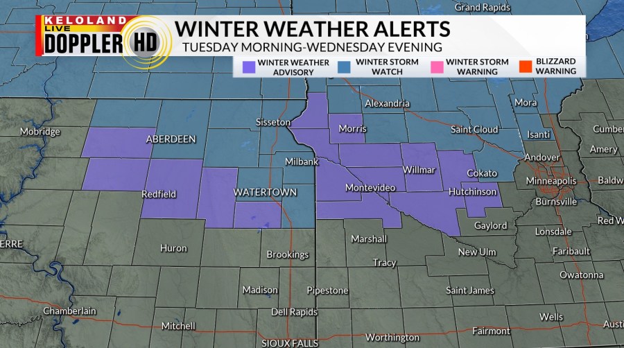
Meanwhile, it’s wintry weather that’s the main concern to the northeast. A winter storm watch is in effect for northeastern South Dakota beginning on Tuesday and lasting through Wednesday evening. Six inches or more of snow will be possible, and blowing snow concerns will also be in place. A winter weather advisory is in place for Edmunds, Faulk, Spink, Clark, and Hamlin Counties for the same time frame. 2 to 5 inches of snow is possible in the advisory area.
Keep an eye out for updates on both weather headlines as we head into the middle of the week.
Low pressure will gradually depart through the evening on Wednesday before lifting out of KELOLAND going into early Thursday. Once we get to this point, we get a chance to quiet down for a few days. Temperatures get back into the 50s in some areas, which is just about average for the start of April.
A few isolated rain and snow showers will be possible West River late Friday into early Saturday, but organized weather is largely absent through the weekend and even into the start of next week.
Here’s a look at your extended forecast:


