


The Dam Rock Station Playing Anything that Rocks!!
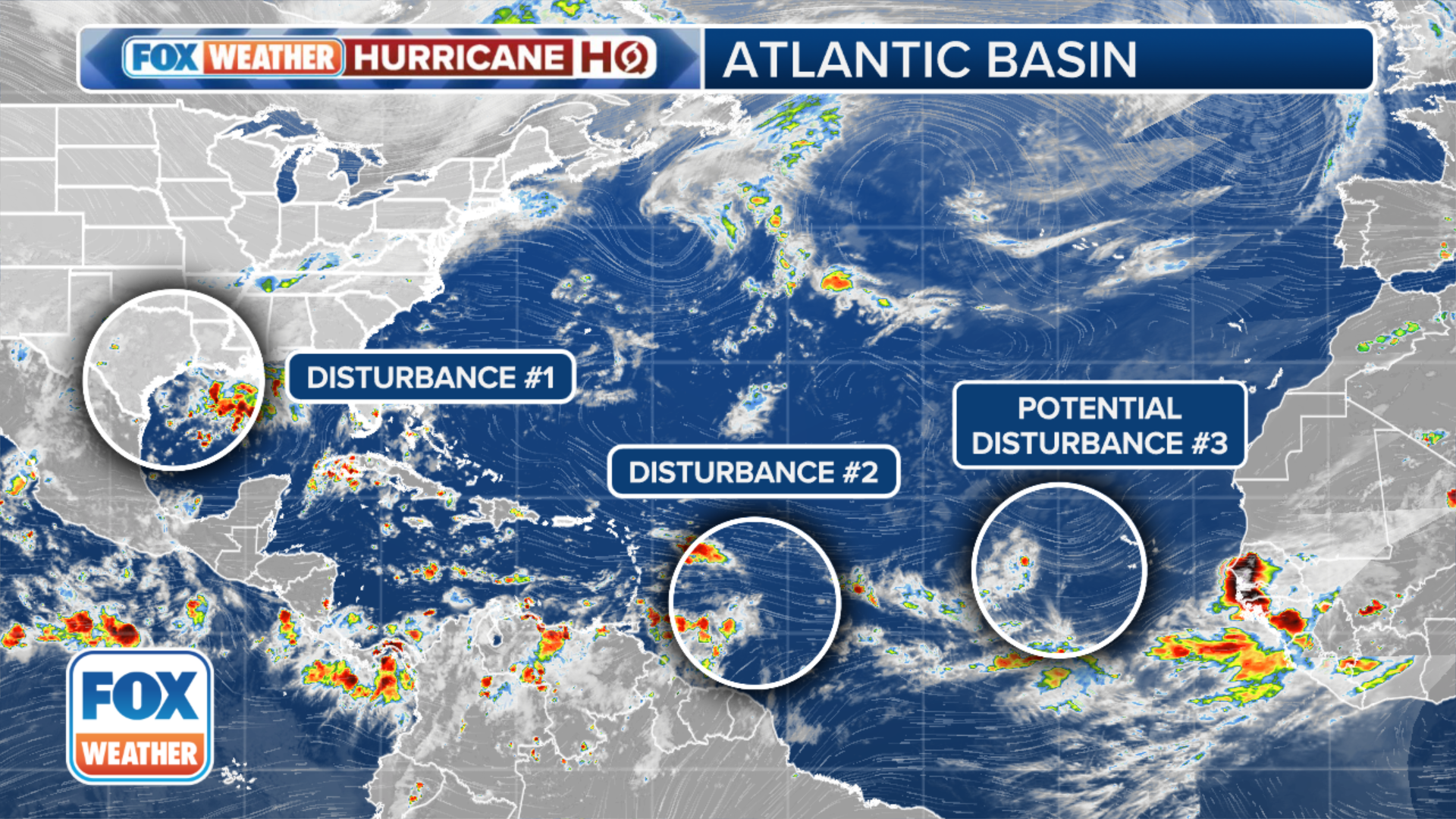
MIAMI – The National Hurricane Center (NHC) is keeping its eyes on a few disturbances for potential tropical development, but it’s the one swirling a few hundred miles east of the Lesser Antilles in the Atlantic that is the primary focus for forecasters.The NHC said the rain and thunderstorm activity associated with that disturbance has changed little in organization since Saturday.HOW TO WATCH FOX WEATHER”The computer model forecasts show a wide variety of possibilities for the future of the system,” said FOX Weather Hurricane Specialist Bryan Norcross. “At one extreme, some forecasts show a hurricane developing in the western Caribbean, while others show little or no development as the disturbance moves west into the southern Gulf of Mexico or Central America.”The NHC has been bouncing the odds of the storm’s tropical development between 40-50% over the next week.The NHC said the disturbance is expected to move west and reach the Lesser Antilles on Monday, and then cross into the eastern Caribbean on Tuesday.”Environmental conditions are forecast to become more conducive for development while the system moves across the central and western Caribbean during the middle and end of the upcoming week.The NHC said that’s when a tropical depression could form.The NHC said a disturbance off the coast of Africa has fizzled and is no longer being monitored, however a new threat could emerge in the area soon.The NHC said a tropical wave moving over western Africa is forecast to move offshore on Monday, and environmental conditions could support some slow development through the upcoming week while it moves slowly to the west or west-northwest over the eastern tropical Atlantic Ocean.A trough of low pressure currently producing a large but disorganized area of thunderstorms along and just offshore the Texas and Louisiana coasts is still clinging to a low chance of tropical development, the NHC says.With little in the way of winds to steer the system, storms are expected to meander near the coast through much of next week. But some slow tropical development is possible if the system remains offshore over the warm Gulf of Mexico waters, according to the NHC.NEW DISTURBANCE IN THE GULF OF MEXICO BEING MONITORED FOR POSSIBLE TROPICAL DEVELOPMENTRight now, the NHC is only giving low odds of development into at least a tropical depression within the next week. The agency warned that regardless of tropical development, heavy rains could cause flash flooding along portions of the Louisiana and upper Texas coasts over the next few days.