


The Dam Rock Station Playing Anything that Rocks!!
SIOUX FALLS, S.D. (KELO) — Severe weather moved through north central South Dakota yesterday evening. We will show you the details from the storm center.
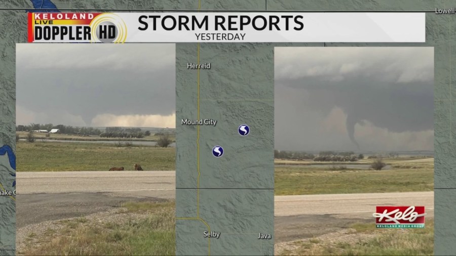
Yesterday’s warm moist air in north central South Dakota interacted with cooler and drier air during the evening to help develop severe storms. These storms quickly became severe and produced tornadoes.
Or should I say, storm. As it was the only storm in KELOLAND during much of the evening. It was able to sustain its strength because it was alone, it didn’t have to share any available energy. A classic super cell storm.
Time-lapse: Tornado near Mound City
Our VIPIR processors were even able to pick up on a debris signature. It’s hard to distinguish it, but it’s circled here. This is where the radar is picking up debris in the air due to the strong winds of the tornado.
The sheriff of Walworth County was able to snap these pictures of the tornado southwest of Mound City. The Aberdeen Weather Service will do a survey of the storm today.
Tornado photos: courtesy Walworth County Sheriff’s Office
Storms will leave eastern KELOLAND by tonight as things will be a lot calmer for the Labor Day weekend as drier and cooler air is expected.