


The Dam Rock Station Playing Anything that Rocks!!
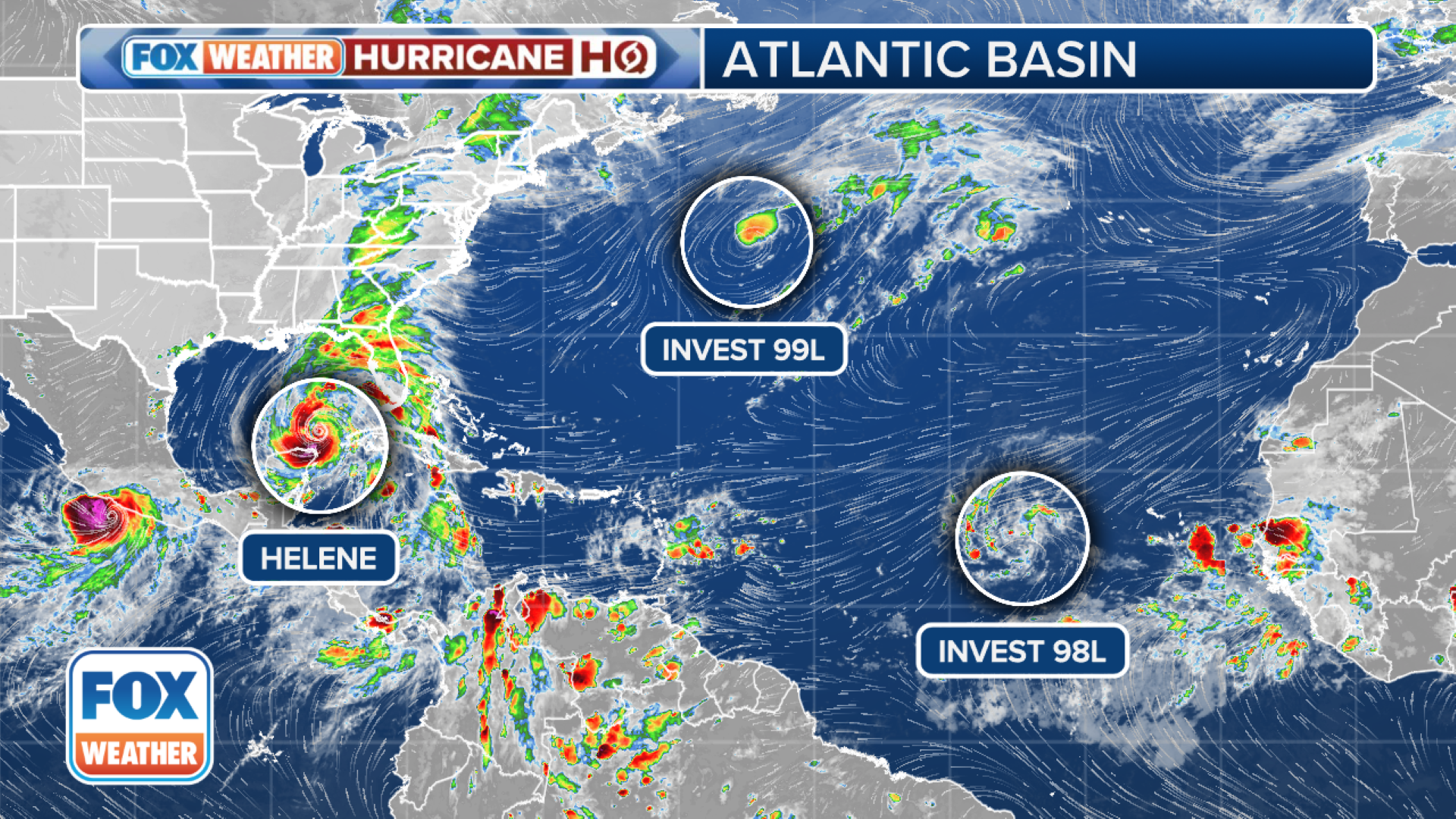
As concern about Hurricane Helene grows in the Gulf of Mexico and the Caribbean, the National Hurricane Center (NHC) is monitoring two additional areas of possible tropical development in the central and eastern Atlantic Ocean.HOW TO WATCH FOX WEATHERThe NHC says showers and thunderstorms have become better organized in a storm several hundred miles northeast of Bermuda. “Recently-received satellite wind data has revealed that the low is no longer attached to a frontal boundary and is producing a concentrated area of tropical-storm-force winds near the center,” the NHC said in its Wednesday night update. “If these trends continue, this system is likely to become a tropical storm shortly.”Right now, the NHC has raised the odds of tropical development to high and if it beats Invest 98L to a name, it’ll claim Issac. Otherwise, Juliet is the following name on the list. Another area being watched is a tropical disturbance dubbed Invest 98L west of the Cabo Verde Islands, according to the NHC.”A broad low-pressure system associated with a tropical wave located west of the Cabo Verde Islands continues to produce disorganized shower and thunderstorm activity,” the NHC said in its latest outlook. “Environmental conditions appear favorable for gradual development of this system, and a tropical depression is likely to form in a few days while it moves westward to west-northwestward across the eastern and central tropical Atlantic.”Right now, the NHC is also giving the system a high chance of development. If it develops into a tropical storm, it will take the name Issac or Juliet depending on who wins the race between it and Invest 99L.DOWNLOAD THE FREE FOX WEATHER APPHurricane Helene is continuing to gain strength as it approaches Florida. Residents are rushing to prepare for a potentially deadly storm surge, hurricane-force winds and flooding rain.The NHC said a life-threatening storm surge is possible along the entire west coast of the Florida Peninsula and Big Bend. As the storm comes ashore late Thursday, the Big Bend area is expected to experience the highest water levels – as much as 20 feet above dry land. Tampa Bay could see 5-8 feet of storm surge inundation under current forecasts.