


The Dam Rock Station Playing Anything that Rocks!!
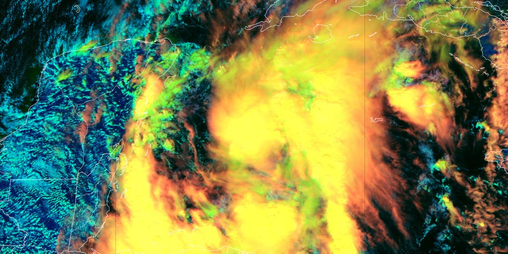
As of Friday at 5:00 P.M. ET, Potential Cyclone Fifteen formed in the Western Caribbean, and may soon become Tropical Storm Nadine. Continuous coverage of Potential Tropical Cyclone Fifteen has moved here.MIAMI – A tropical disturbance swirling off southern Mexico is now looking like it’s going to soon develop into at least a tropical depression or even possibly Tropical Storm Nadine, before it makes landfall hours later. Widespread showers and thunderstorms across the northwestern Caribbean associated with the disturbance currently designated Invest 95L became more organized Friday, and atmospheric conditions suggest 95L could generate additional development over the next 24 hours as it spends its final hours over warm water.Forecasters with the National Hurricane Center (NHC) now give 70% odds the disturbance will reach at least tropical depression status by Saturday.However, the disturbance – no matter what form it ultimately takes – is expected to move inland over Central America on Saturday. Tropical Storm Watches or Warnings may need to be issued later Friday, the NHC warned. HOW TO WATCH FOX WEATHER”Interests in Belize and the Yucatan Peninsula of Mexico should monitor the progress of this system,” the NHC said. “Regardless of development, locally heavy rainfall is likely across portions of Central America.”The disturbance is no threat to the U.S. FOX Weather Hurricane Specialist Bryan Norcross said the hostile atmospheric conditions over the Florida and northern Gulf of Mexico should keep any potential tropical systems from threatening the U.S. for the foreseeable future. Meanwhile, after nearly wiping Invest 94L off the board Friday morning, the NHC has reversed course and given a slight boost to the odds of development.The broad area of low-pressure east of the Leeward Islands that has been producing disorganized precipitation and thunderstorms.”The disturbance still has a reasonably well-defined but broad circulation,” Norcross said. “But dry air has not allowed thunderstorms to organize and persist, which in turn would tighten the circulation – the requirements for the tropical depression designation.”DOWNLOAD THE FREE FOX WEATHER APPThe system is expected to skirt a few hundred miles north of Puerto Rico and the Virgin Islands Friday, then near Hispaniola and the southeastern Bahamas this weekend. “Further development is not expected due to strong upper-level winds by early next week,” the NHC said.For the millions of people in Florida still recovering from back-to-back major hurricanes, Helene and Milton, Invest 94L doesn’t appear to be impacting the Sunshine State at this time. “There is no threat to Florida or the southeastern U.S., but everyone on the northeastern Caribbean islands should stay informed just to be sure the disturbance doesn’t misbehave,” Norcross said.