


The Dam Rock Station Playing Anything that Rocks!!
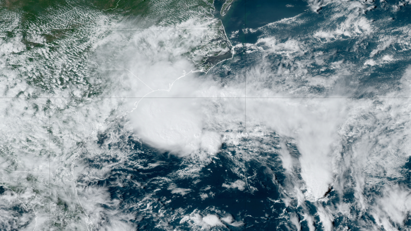
WILMINGTON, N.C. – Potential Tropical Cyclone Eight formed off the Southeast U.S. coast on Sunday and is expected to become Tropical Storm Helene early this week. The National Hurricane Center (NHC) said the system formerly known as Invest 95L is now being called a potential tropical cyclone so that it could issue tropical storm alerts along the Southeast coast. A Tropical Storm Warning was issued for the North Carolina and South Carolina coasts.HOW TO WATCH FOX WEATHERPotential Tropical Cyclone Eight is located about 100 miles from Charleston, South Carolina. WHAT IS A POTENTIAL TROPICAL CYCLONE?A Tropical Storm Warning is in effect for Edisto Beach, South Carolina northward to Ocracoke Inlet, North Carolina.WHAT TO DO WHEN HURRICANE OR TROPICAL STORM WATCHES AND WARNINGS ARE ISSUED FOR YOUR TOWNPotential Tropical Cyclone Eight is likely to bring gusty winds, heavy rain with the potential for flash flooding, coastal flooding and dangerous beach conditions to portions of the Southeast and mid-Atlantic coasts over the next couple of days, the NHC warned. It could become a subtropical or tropical storm in the next day.Computer forecast models show a widespread swath of 2-5 inches of rainfall, with locally higher amounts possible mainly east of Interstate 95. This includes the coastal communities of Myrtle Beach in South Carolina and Wilmington and Morehead City in North Carolina. NOAA’s Weather Prediction Center has highlighted northeastern South Carolina, eastern North Carolina and southeastern Virginia for potential flooding on Monday.A general 1-3 inches of rain is still expected in inland cities such as Raleigh and Charlotte in North Carolina and even Richmond in Virginia.WATCH: HURRICANE ERNESTO’S SWELL CAUSES NORTH CAROLINA HOUSE TO COLLAPSE INTO OCEANThe formation of the potential tropical cyclone brings an increased threat for rip currents, and the potential for additional coastal erosion. The coastline around North Carolina’s Outer Banks and southeastern Virginia is highly susceptible to rough seas, as evidenced by swells created by Hurricane Ernesto that were over 1,000 miles away. WHEN IS THE TYPICAL LAST HURRICANE STRIKE ON THE US COAST?Waves triggered by the once-Category 2 hurricane caused flooding along North Carolina Highway 12, the main thoroughfare through the islands. At least one abandoned home collapsed into the ocean.Following the collapse, parts of Cape Hatteras National Seashore were off-limits to swimmers due to concerns about debris in the water.So far, authorities have given no indications that the surf produced by Potential Tropical Cyclone Eight will outdo the swells of Ernesto or claim any more homes, but the local National Weather Service office in Morehead City, North Carolina, has issued various advisories for beachgoers and boaters, warning about the rough conditions.