


The Dam Rock Station Playing Anything that Rocks!!
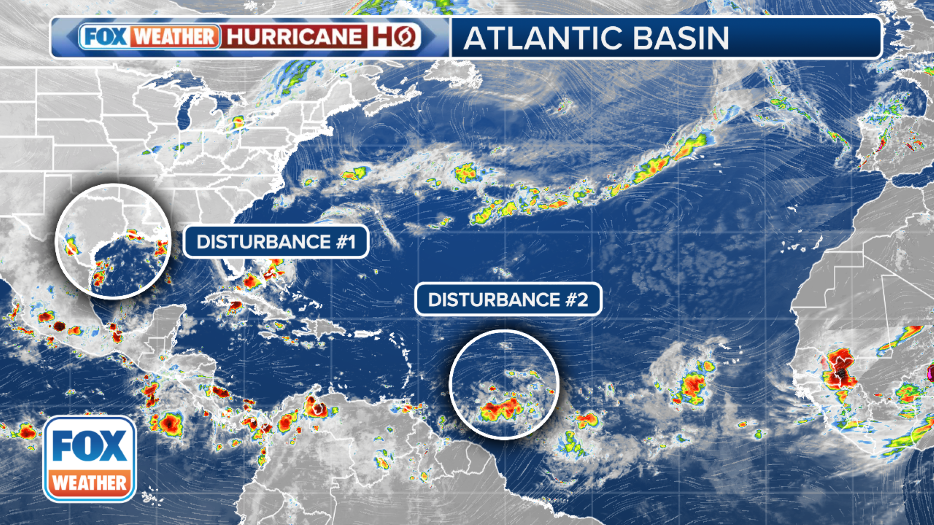
MIAMI — A tropical wave that is swirling several hundred miles east of the Lesser Antilles in the Atlantic is now the primary focus of the National Hurricane Center for future tropical trouble, though a system drenching the Gulf Coast this weekend still has some eyes on it.The disturbance that is now east of the Caribbean is still producing just an area of disorganized thunderstorms. The wave is expected to continue moving west, reaching the Lesser Antilles by Monday, then cross the eastern and central Caribbean Sea through the middle of the week, the NHC says.”Late next week, this system could be over extremely warm water and under conducive atmospheric conditions for strengthening in the western Caribbean Sea,” said FOX Weather Hurricane Specialist Bryan Norcross. “But it has to get organized first, so no confident forecasts are possible.”The NHC has been bouncing the odds of the storm’s tropical development between 40-50% over the next week, a level which Norcross thinks it’ll remain until the system shows better signs of organization.”Many long-range forecasts show the system bending to the north into the Gulf (of Mexico) around next weekend, but that’s so far out that we can’t pay attention to any specific forecasts,” Norcross said. “At this point, just be aware of a potential storm threat near Mexico’s Yucatán Peninsula about next weekend, and in the Southeast the following week.”Another disturbance that the NHC had been tracking as it had just moved off the western African Coast is no longer expected to develop after running into unfavorable conditions.The disturbance was closer to Africa than any other landmass but will remain harmlessly out over the open Atlantic.A trough of low pressure currently producing a large but disorganized area of thunderstorms along and just offshore the Texas and Louisiana coasts is still clinging to a low chance of tropical development, the NHC says.With little in the way of winds to steer the system, storms are expected to meander near the coast through much of next week. But some slow tropical development is possible if the system remains offshore over the warm Gulf of Mexico waters, according to the NHC.NEW DISTURBANCE IN THE GULF OF MEXICO BEING MONITORED FOR POSSIBLE TROPICAL DEVELOPMENTRight now, the NHC is only giving low odds of development into at least a tropical depression within the next week. The agency warned that regardless of tropical development, heavy rains could cause flash flooding along portions of the Louisiana and upper Texas coasts over the next few days, with some areas forecast to receive 5 inches of rain through the weekend. A Flash Flood Watch was in place for New Orleans and parishes south and west of the metro through at least the first half of the weekend.